কনটেন্টটি শেষ হাল-নাগাদ করা হয়েছে: সোমবার, ১৭ জুলাই, ২০২৩ এ ০৬:১৩ PM
GeoUPAC প্রকল্প কর্তৃক প্রণীত মানচিত্রসমূহ
কন্টেন্ট: পাতা
| ক্রমিক | মানচিত্রের নাম (ফরিদপুর জোন ) | ভিউ/ ডাউনলোড |
| ১। | Local Peak Ground Acceleration (LPGA) Map of Faridpur Town and Surrounding Area | 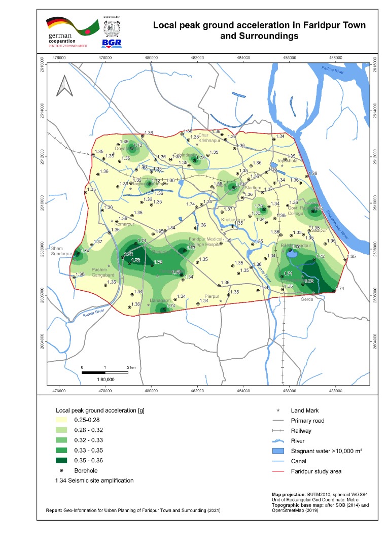 |
| ২। | Bearing Capacity Maps (shallow and deep foundation) of Faridpur Town and Surrounding Area | 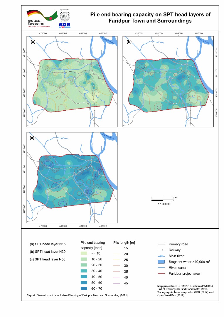 |
| ৩। | Liquefaction Potential Index (sLPI) Map of Faridpur Town and Surrounding Area | 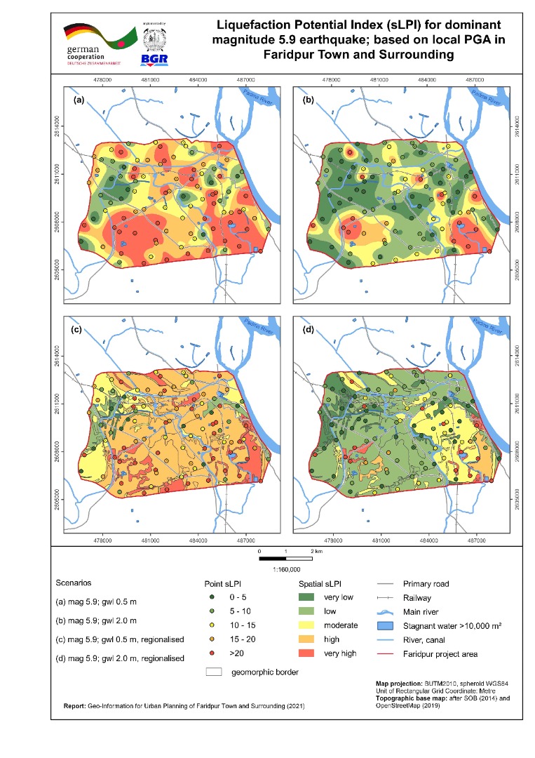 |
| ৪। | Seismic Site Class Map (Vs30) of Faridpur Town and Surrounding Area | 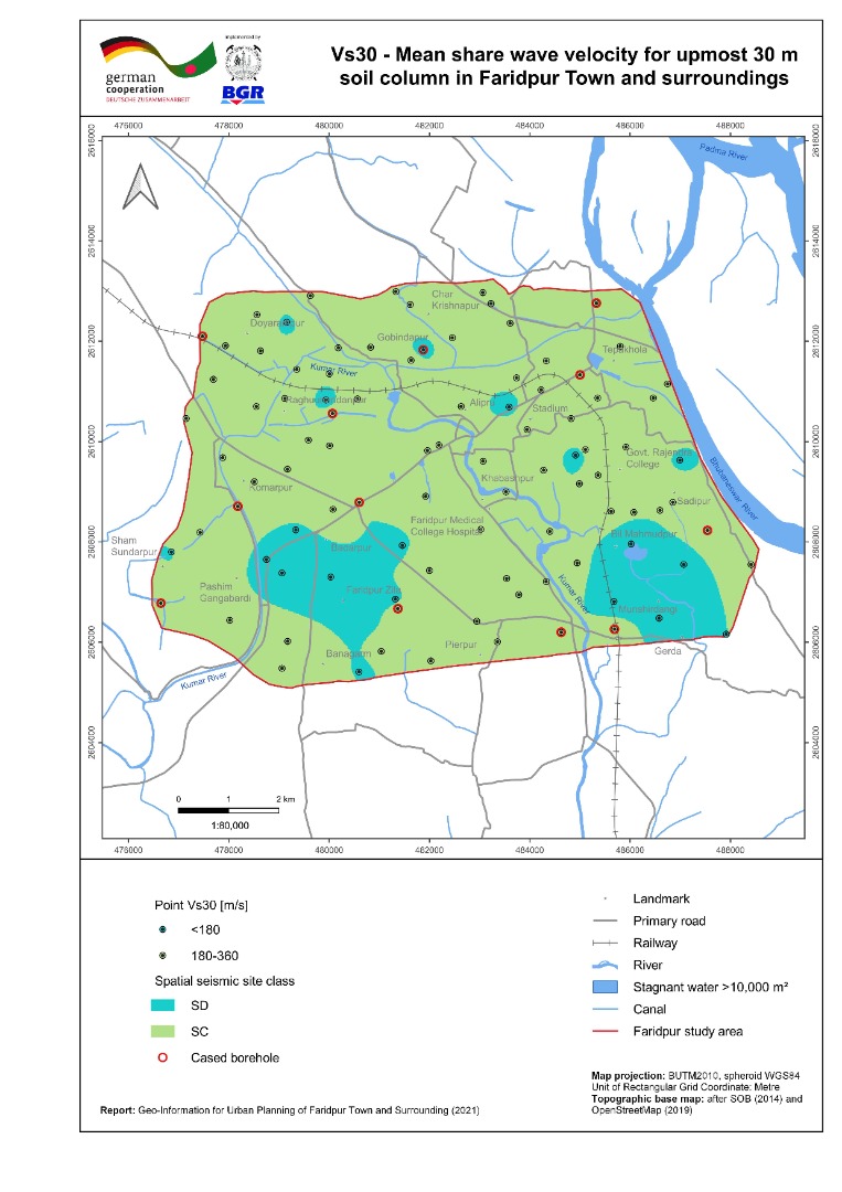 |
| ৫। | Geomorphic Map of Faridpur Town and Surrounding Area | 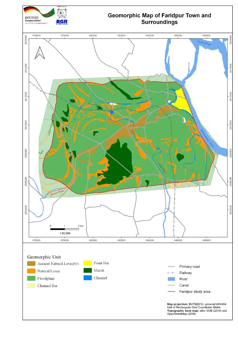 |
| ৬। | Inundation Map of Faridpur Town and Surrounding Area | 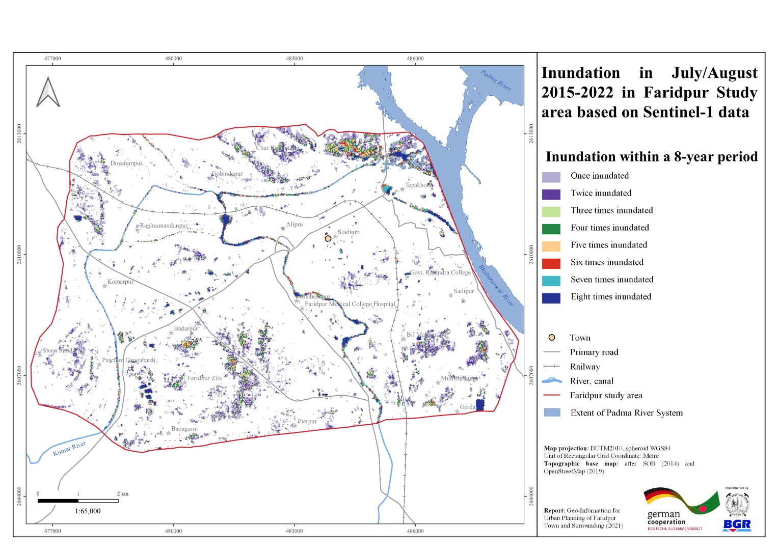 |
| ৭। | Land Use Map of Faridpur Town and Surrounding Area | 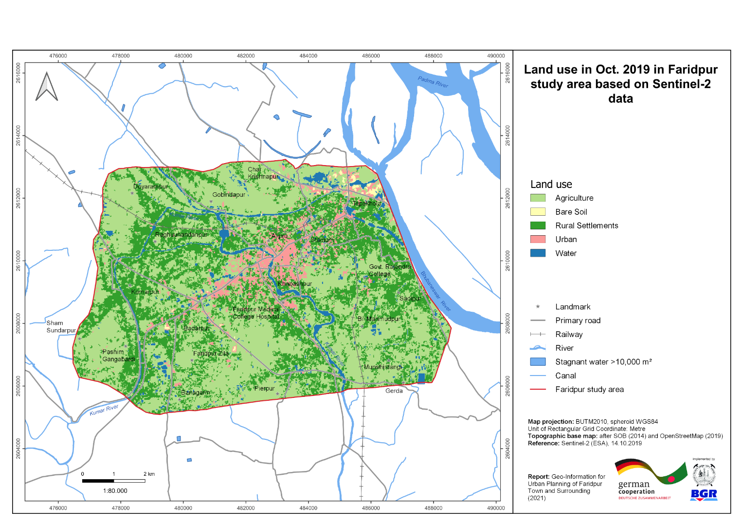 |
| ৮। | River Course Change Detection Map of Faridpur Town and Surrounding Area | 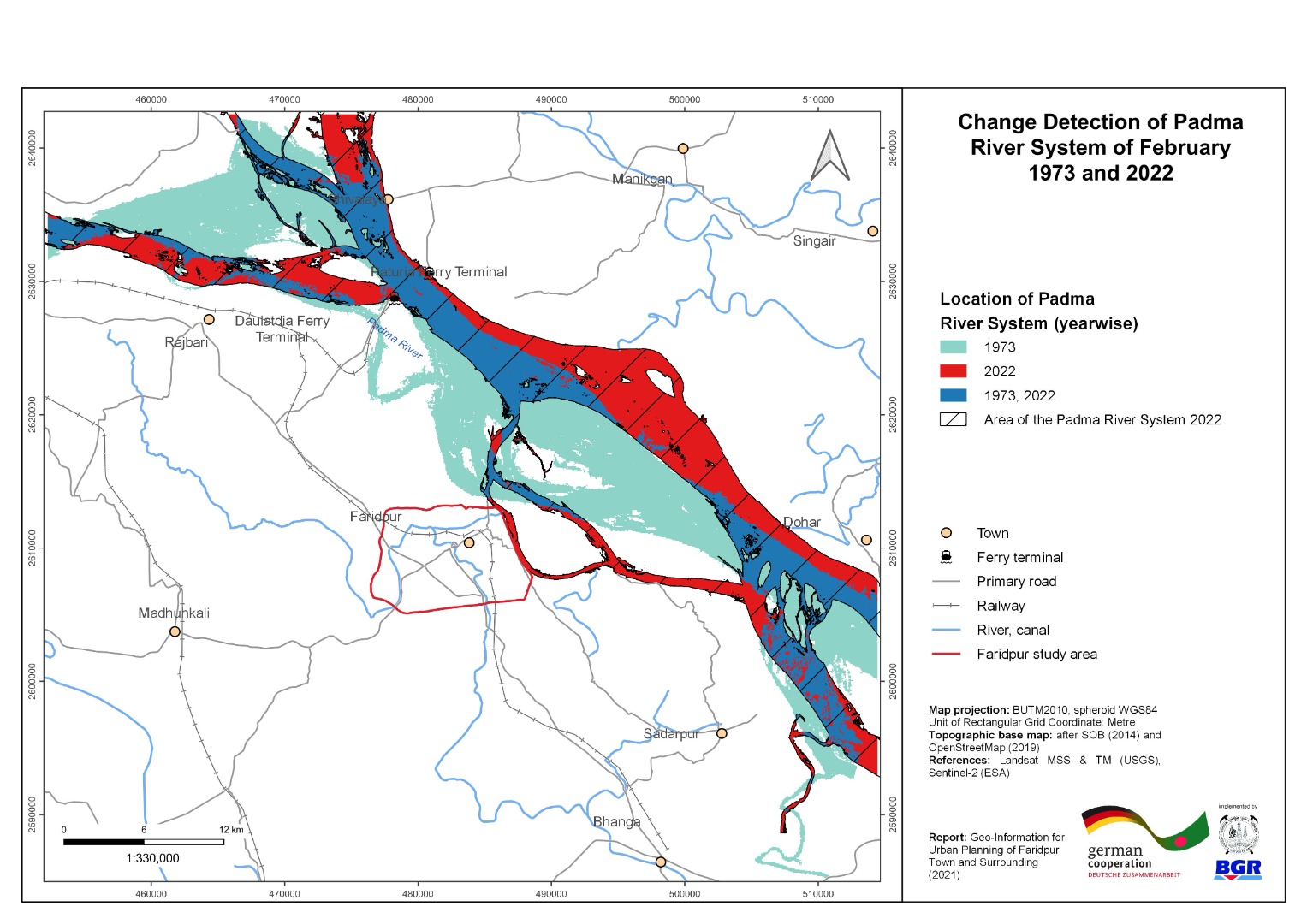 |
| ৯। | Vertical Ground Motion Map of Faridpur Town and Surrounding Area | 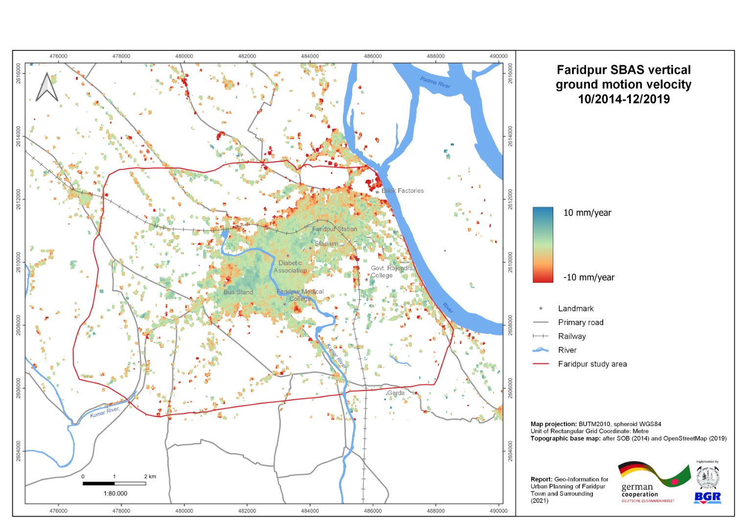 |
| ১০। | 3-D geological Model with cross-section of Faridpur Town and Surrounding Area | 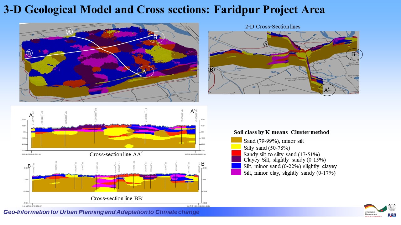 |
| ১১। | Building Ground Suitability Map of Faridpur Town and Surroundings |  |
| ক্রমিক | মানচিত্রের নাম (বরিশাল জোন ) | ভিউ/ ডাউনলোড |
| ১। | Local Peak Ground Acceleration (LPGA) Map of Barishal Town and Surrounding Area | 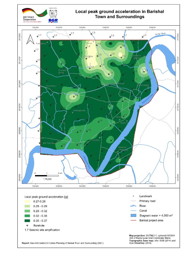 |
| ২। | Bearing Capacity Maps (shallow and deep foundation) of Barishal Town and Surrounding Area | 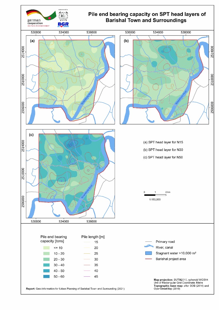 |
| ৩। | Liquefaction Potential Index (sLPI) Map of Barishal Town and Surrounding Area | 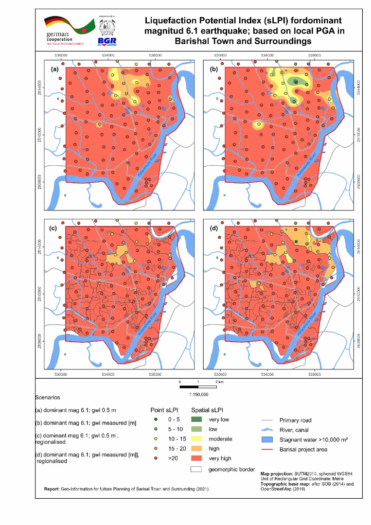 |
| ৪। | Seismic Site Class Map (Vs30) of Barishal Town and Surrounding Area | 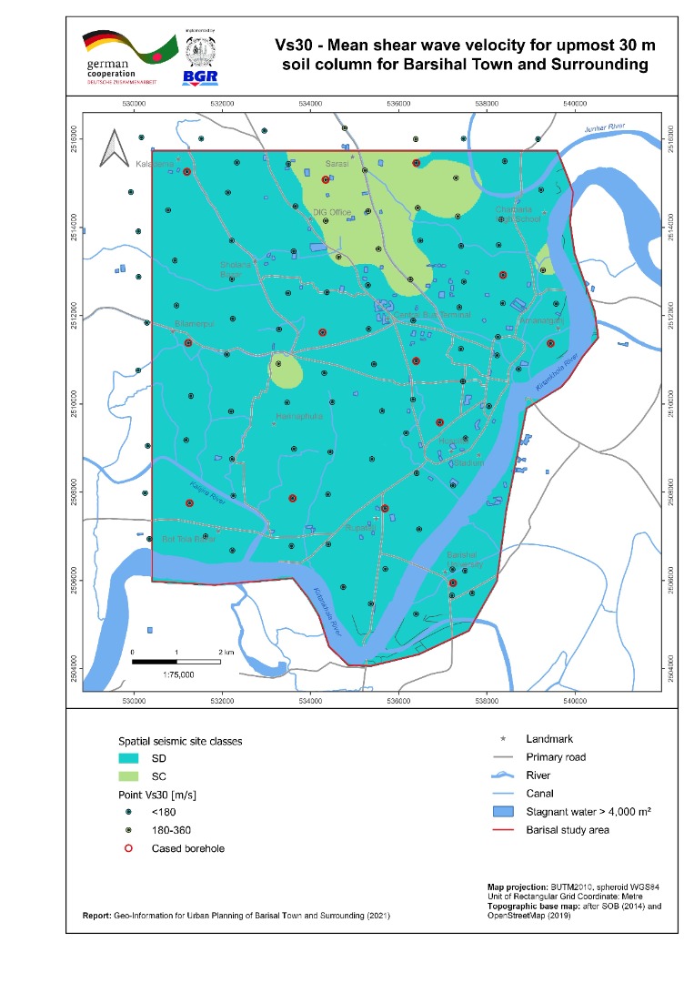 |
| ৫। | Geomorphic Map of Barishal Town and Surrounding Area | 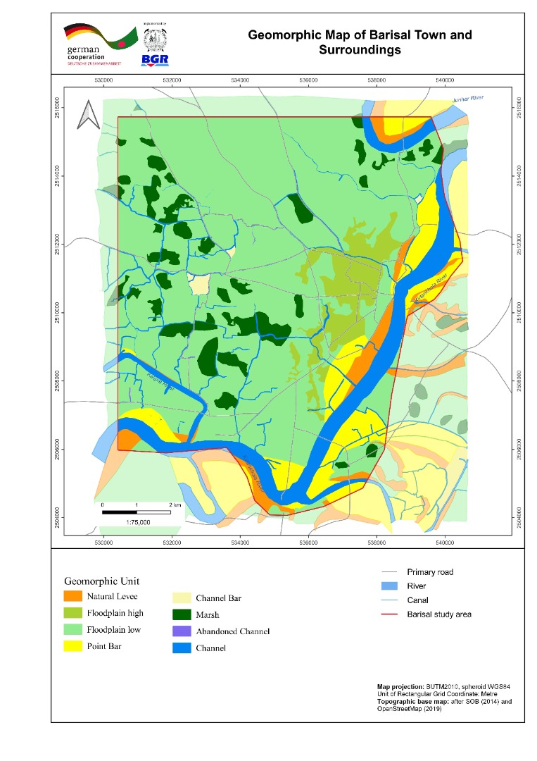 |
| ৬। | Inundation Map of Barishal Town and Surrounding Area | 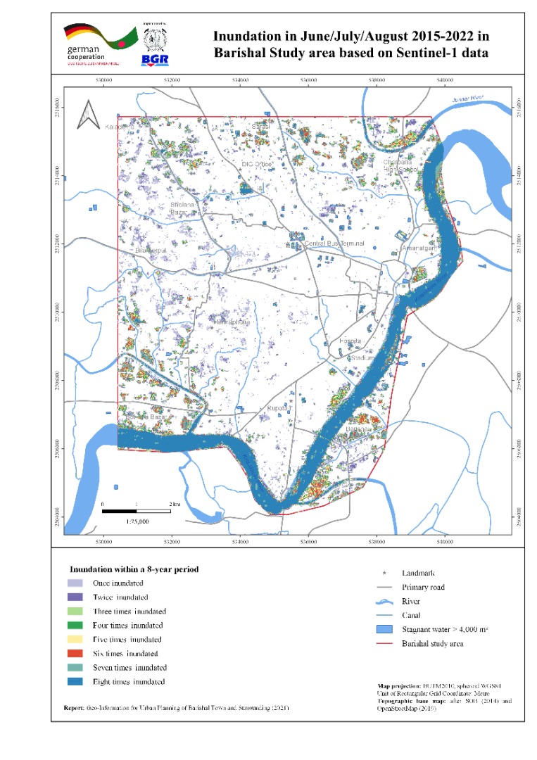 |
| ৭। | Land Use Map of Barishal Town and Surrounding Area | 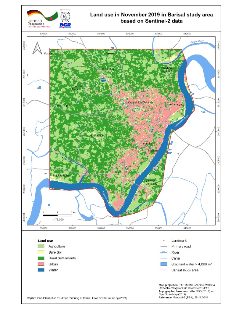 |
| ৮। | River Course Change Detection Map of Barishal Town and Surrounding Area | 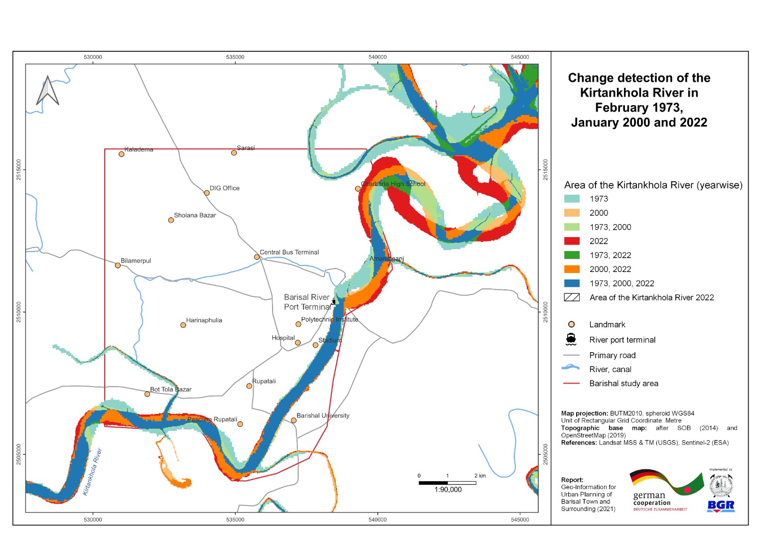 |
| ৯। | Vertical Ground Motion Map of Barishal Town and Surrounding Area | 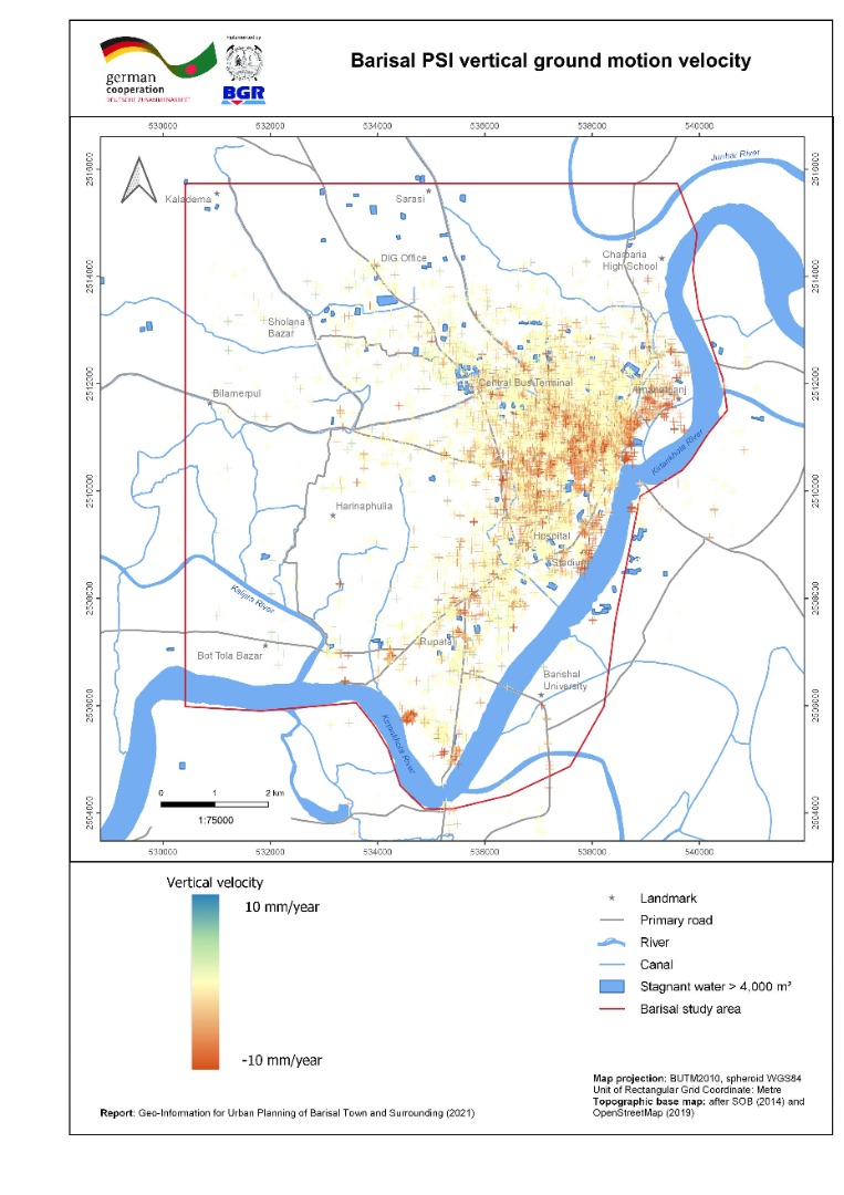 |
| ১০। | 3-D geological Model with cross section of Barishal Town and Surrounding Area | 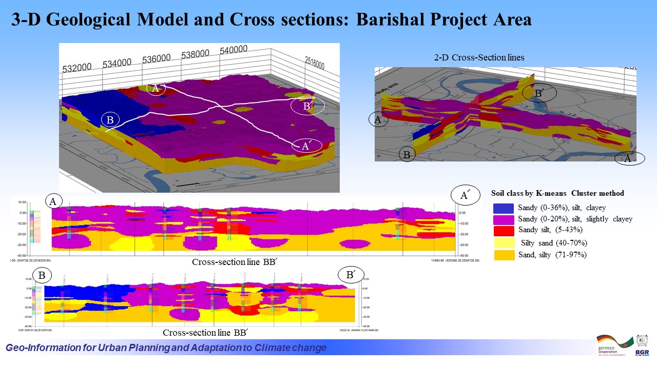 |
| ১১। | Building Ground Suitability Map of Barishal Town and Surroundings | |
| ক্রমিক | মানচিত্রের নাম (খুলনা জোন ) | ভিউ/ ডাউনলোড |
| ১। | Local Peak Ground Acceleration (LPGA) Map of Khulna Town and Surrounding Area | 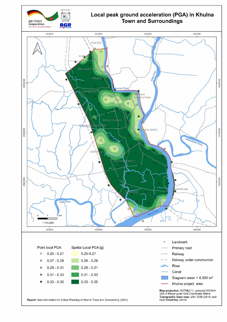 |
| ২। | Bearing Capacity Maps (shallow and deep foundation) of Khulna Town and Surrounding Area | 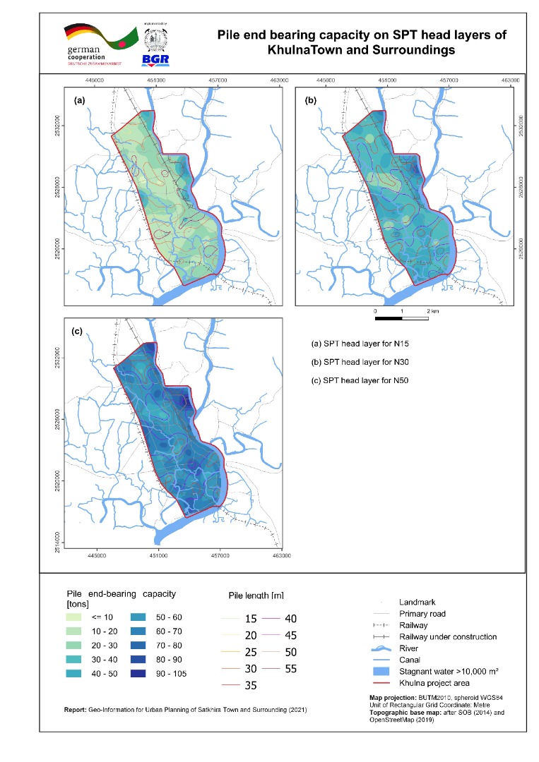 |
| ৩। | Liquefaction Potential Index (sLPI) Map of Faridpur Town and Surrounding Area | 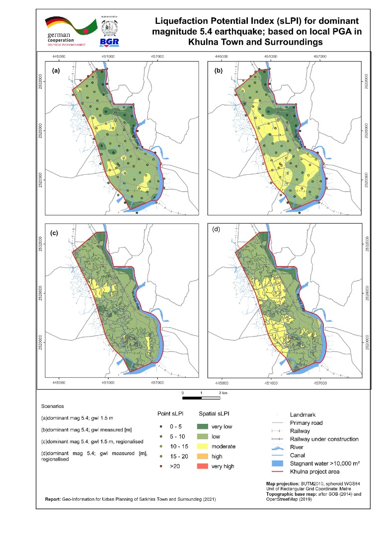 |
| ৪। | Seismic Site Class Map (Vs30) of Khulna Town and Surrounding Area | 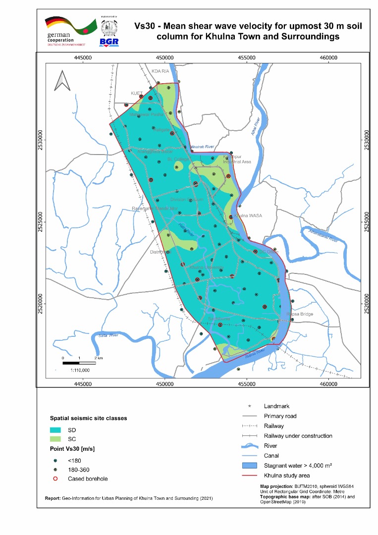 |
| ৫। | Geomorphic Map of Khulna Town and Surrounding Area | 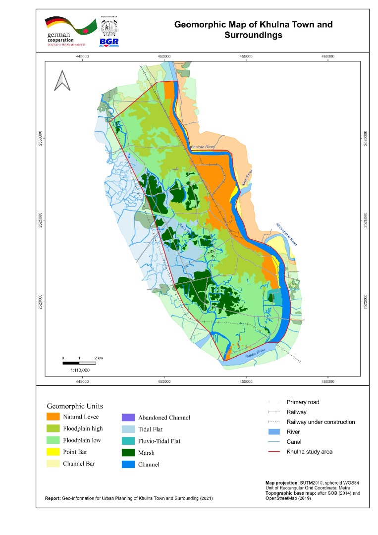 |
| ৬। | Inundation Map of Khulna Town and Surrounding Area | 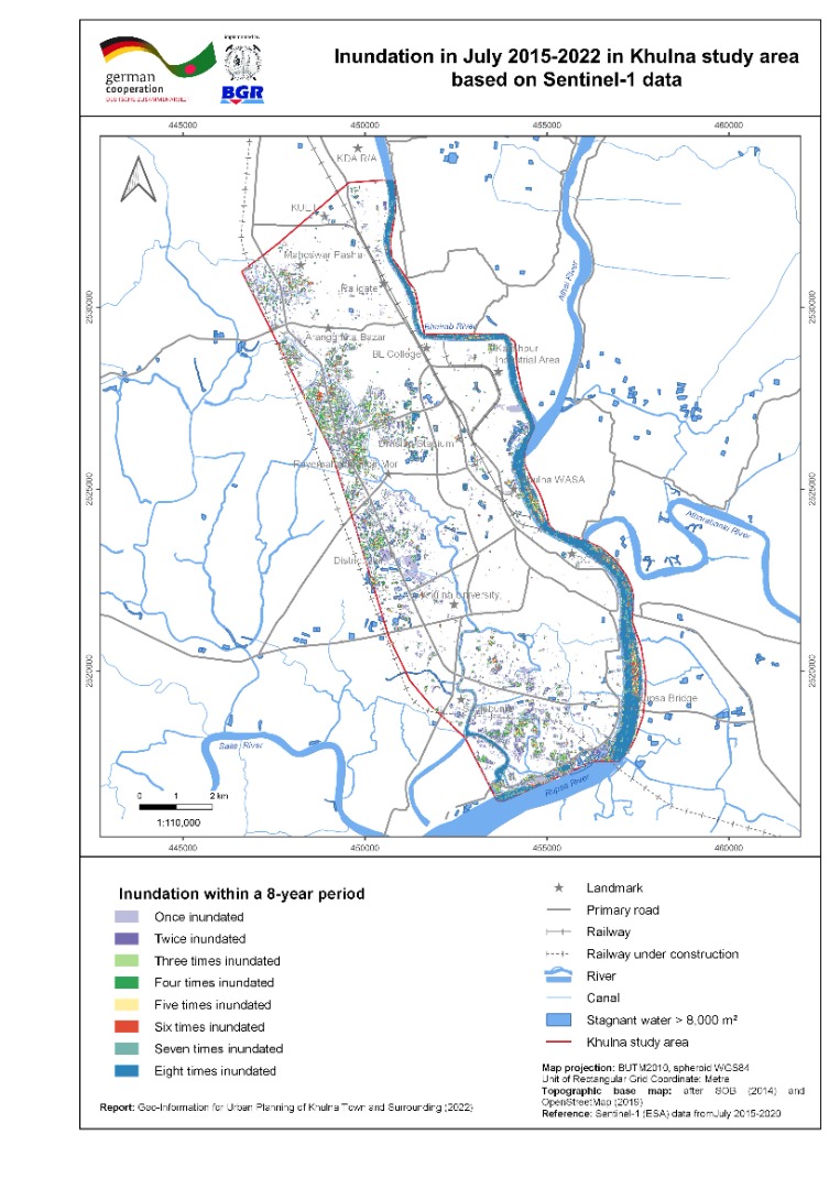 |
| ৭। | Land Use Map of Khulna Town and Surrounding Area | 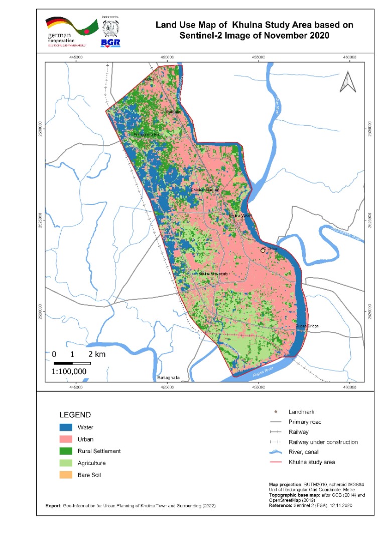 |
| ৮। | River Course Change Detection Map of Khulna Town and Surrounding Area | 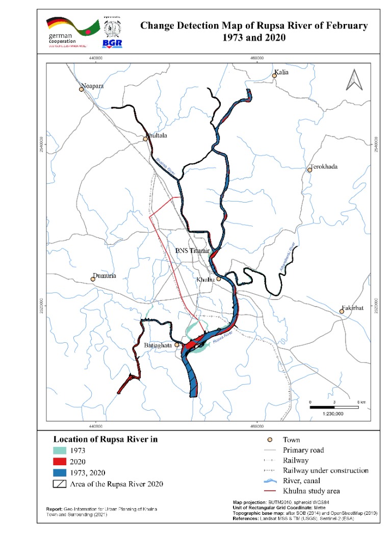 |
| ৯। | Vertical Ground Motion Map of Khulna Town and Surrounding Area | 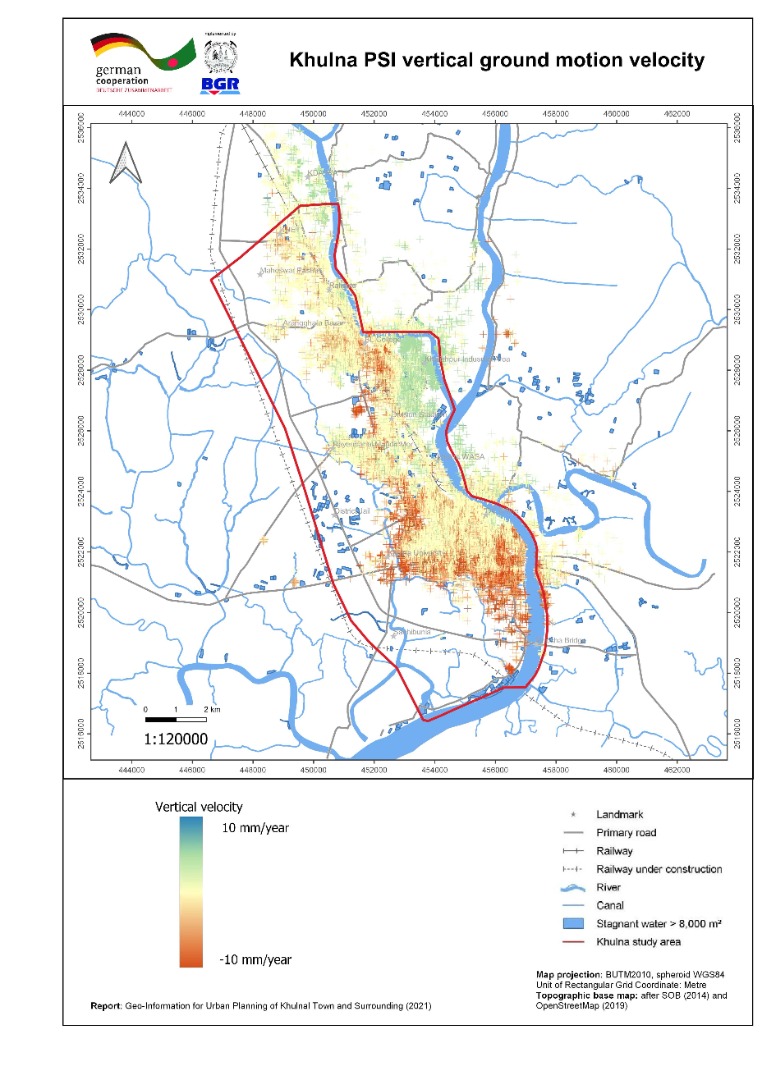 |
| ১০। | 3-D geological Model with cross section of Khulna Town and Surrounding Area | 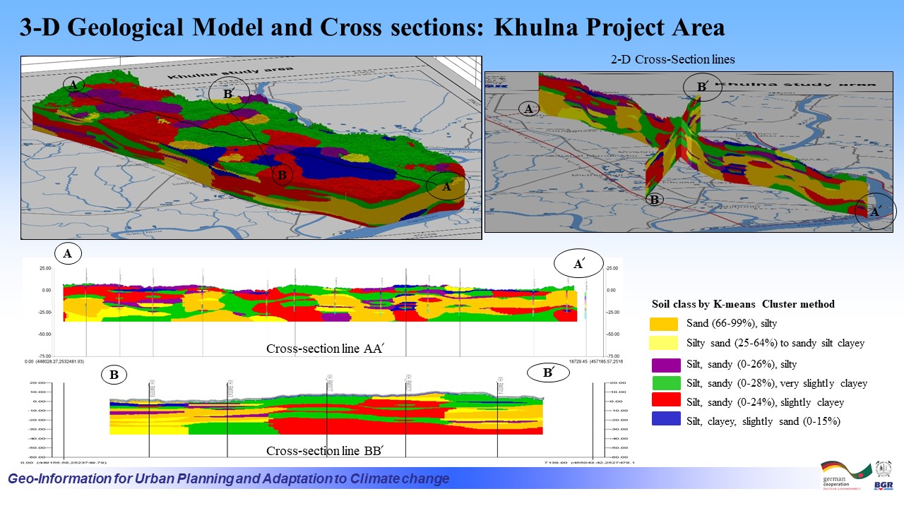 |
| ১১। | Building Ground Suitability Mapof Khulna Town and Surroundings | |
| ক্রমিক | মানচিত্রের নাম (সাতক্ষীরা জোন ) | ভিউ/ ডাউনলোড |
| ১। | Local Peak Ground Acceleration (LPGA) Map of Satkhira Town and Surrounding Area | 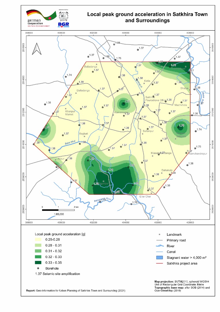 |
| ২। | Bearing capacity maps (shallow and deep foundation) of Satkhira Town and Surrounding Area | 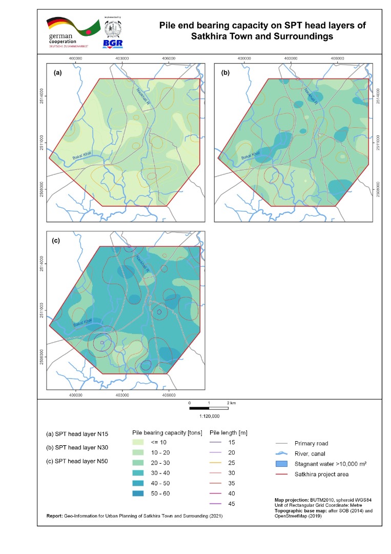 |
| ৩। | Liquefaction Potential Index (sLPI) Map of Satkhira Town and Surrounding Area | 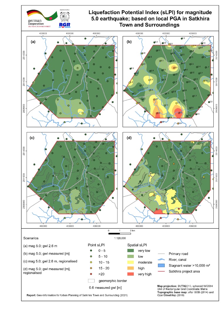 |
| ৪। | Seismic Site Class Map (Vs30) of Satkhira Town and Surrounding Area | 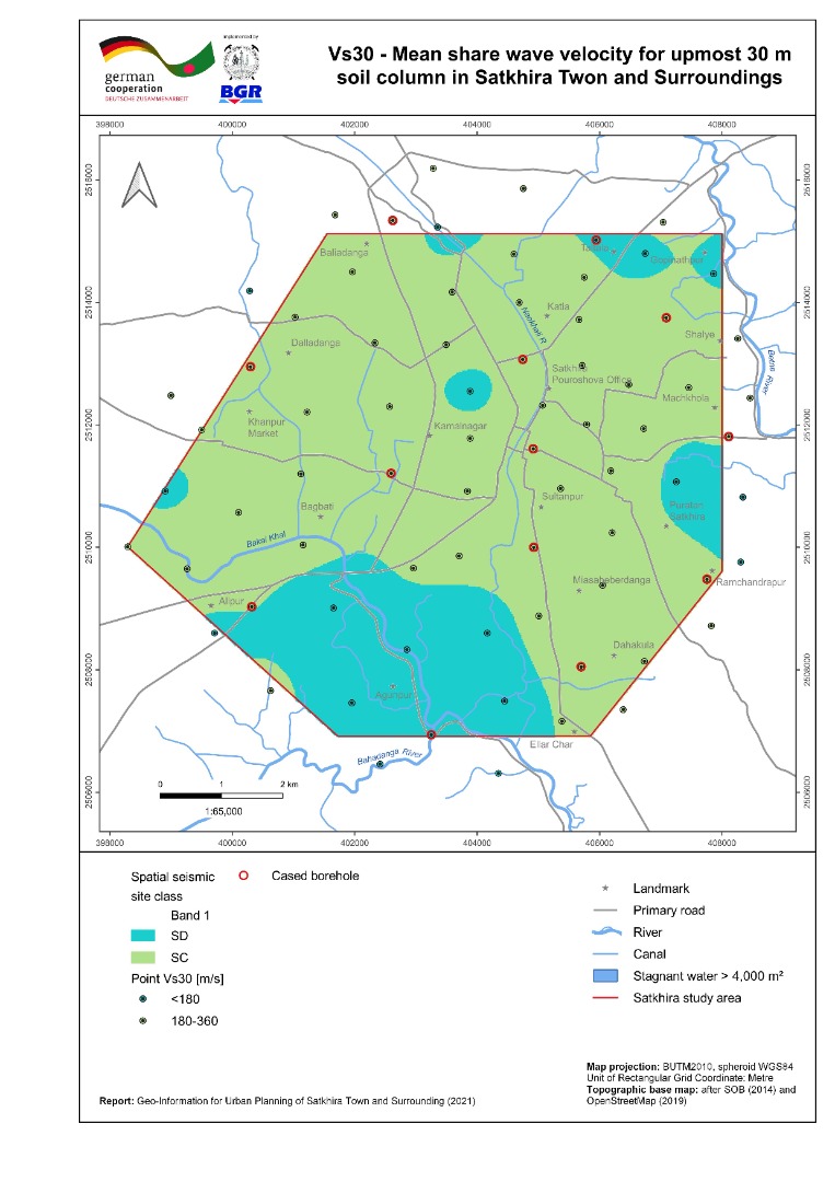 |
| ৫। | Geomorphic Map of Satkhira Town and Surrounding Area | 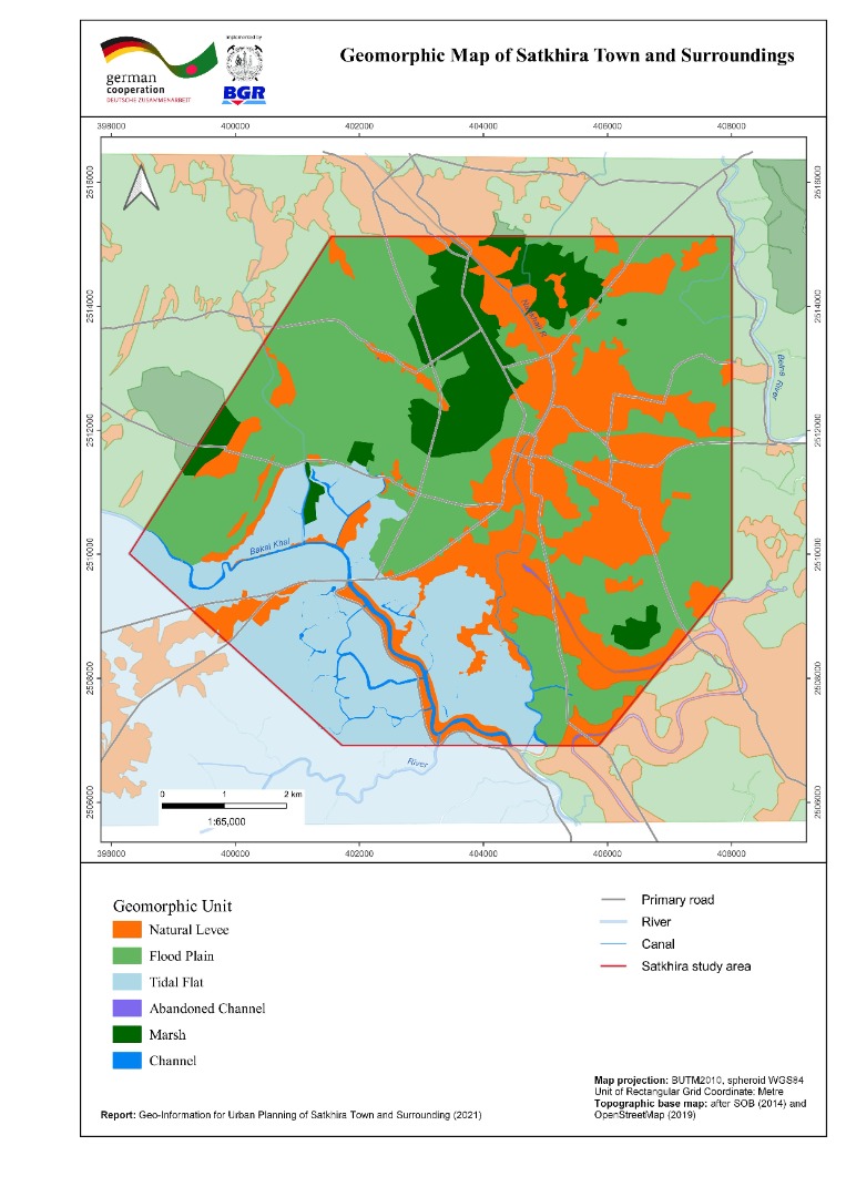 |
| ৬। | Inundation Map of Satkhira Town and Surrounding Area | 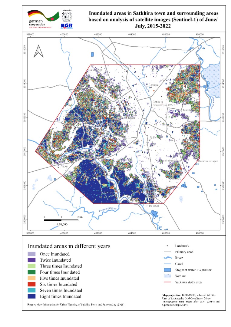 |
| ৭। | Land use map of Satkhira Town and Surrounding Area | 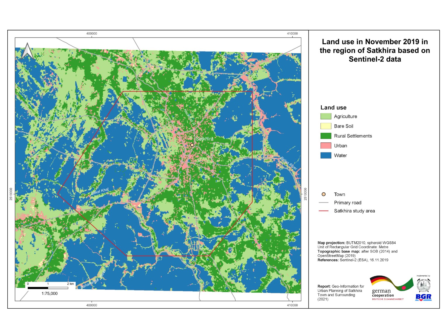 |
| ৮। | Vertical Ground Motion Map of Satkhira Town and Surrounding Area | 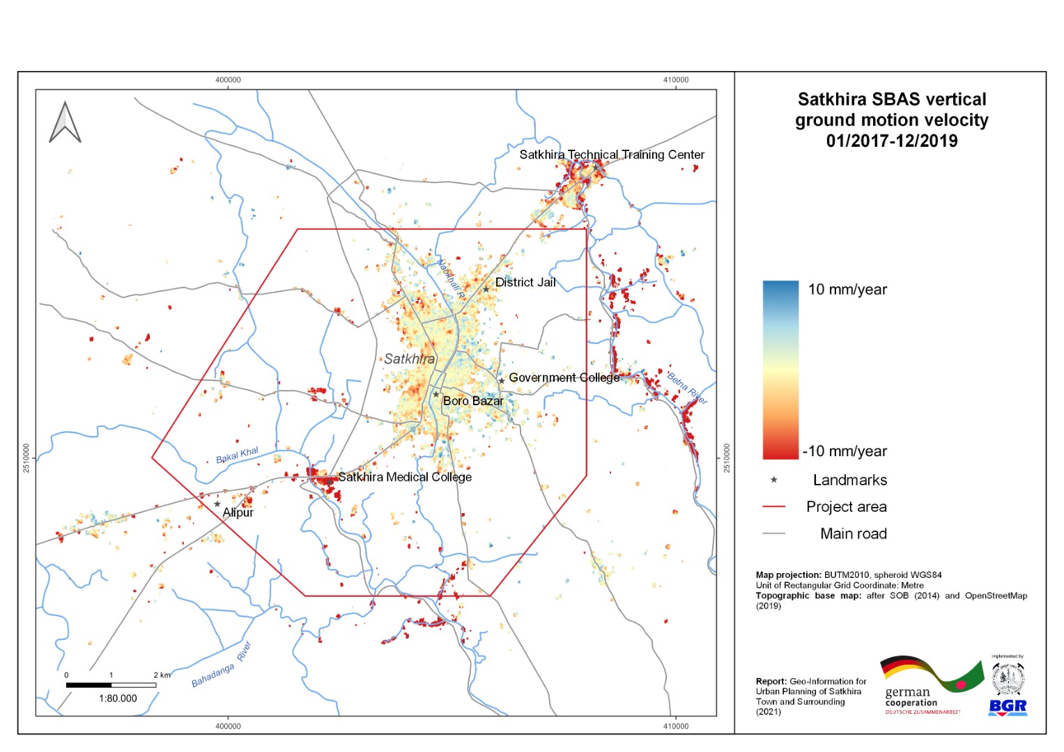 |
| ৯। | 3-D geological Model with cross-section of Satkhira Town and Surrounding Area | 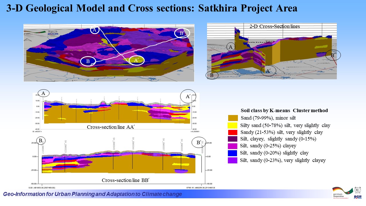 |
| ১০। | Building Ground Suitability Map of Satkhira Town and Surroundings | 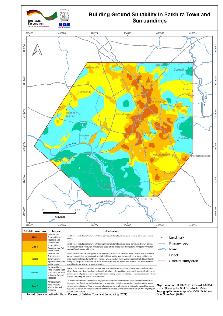 |
| ক্রমিক | অন্যান্য | ভিউ/ডাউনলোড |
| ১। | Regional Peak Ground Acceleration with 2% exceedance probability in 50 years, in and around Bangladesh |  |
| ২। | Regional Peak Ground Acceleration with 10% exceedance probability in 50 years, in and around Bangladesh | 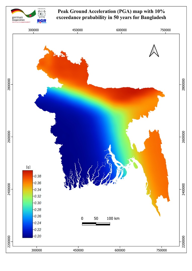 |