|
জেলা
|
উপজেলা/এলাকা
|
ভূ-বৈজ্ঞানিক তথ্যাবলী
|
|
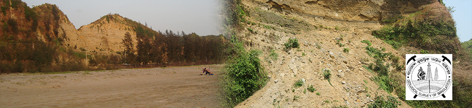
চট্টগ্রাম
|
চট্টগ্রাম শহর
|
- Geological map at scale 1:20,000 (1990), 1:30000 (2009, under GSB- CDMP-1)
- Geomorphological map at scale 1:30000, (2009, under GSB-CDMP-1)
- Engineering geological map at scale 1:30000, (2009, under GSB-CDMP-1)
- Near-surface Engineering map at scale 1:20,000 (1990)
- Sub-surface Engineering map at scale 1:20,000 (1990)
- Hydrography of Karnaphuli River (1990)
- Hazard (Slope instability, Excavation & fills, Soft soils, Siltation at river mouth) analysis (1990)
- Causes of Landslide on 11 June 2007 (2007)
- Geological analysis for devastating landslides on 26 June 2012 (2012)
- Suitability of light-weight indigenous rock (Shales, Claystones, etc.) for production (1969)
- Reserve of light-weight indigenous rock aggregates (1969)
- Study on landslide (causes, vulnerability and remedy) (1995)
- Risk reduction by installing weather station in landslide prone areas (2012, GSB-NGI)
- Weak zone identification at Chattogram city outer ring road (2016)
- Slope stability analysis (2018)
- Geotechnical properies characterization (2018)
- Mapping for Phosphorite prospect at scale of 1:20000 (1977)
- Occurrence of Red-oxide (1983)
- Stratigraphic investigation (1988)
|
|
আনোয়ারা
|
- Study on landslide (causes, vulnerability and remedy) (1995)
- Geological map at scale 1:50000 (2004)
- Coastline change detection map (from 1943 to 2000) at scale 1:50000 (2004)
- Integrated natural hazard map at scale 1:50000 (2004)
- Land use map at scale 1:50000 (2004)
- Land Suitability map at scale 1:50000 (2004)
- Engineering geological map of Jaldia Marcentile Marine Academy area at scale 1:3600 (1981)
- Landslide mapping of Jaldia Marcentile Marine Academy area (1981)
- Characterization of slope instability and construction damage of Jaldia Marcentile Marine Academy area (1981)
|
|
বাঁশখালী
|
- Geological map at scale 1:50000 (2004)
- Coastline change detection map (from 1943 to 2000) at scale 1:50000 (2004)
- Integrated natural hazard map at scale 1:50000 (2004)
- Land use map at scale 1:50000 (2004)
- Land Suitability map at scale 1:50000 (2004)
- Geological analysis for devastating landslides at 26 June 2012 (2012)
- Stratigraphy of this area (1984)
- Mineral resource investigation (1984)
- Geologic map (some part of Baskhali) at scale 1:50000 (1984)
|
|
বোয়ালখালী
|
-
|
|
চন্দনাইশ
|
- Geological map of Dohazari at scale 1:30,000 (1965)
- Investigation of landslide on 13 June 2017 (2020)
|
|
ফটিকছড়ি
|
- Geological map of ( Karerhat-kalia-Jaliapara-Ramgarh road section) at scale 1:50000 (1986)
|
|
হাটহাজারী
|
- Geological map of Northern font of Sitakund anticline at scale 1:250,000 (1979)
- Calcareous sandstone characterization (chemical analysis, %, reserve estimation, economic assessment) at Sitakund Anticline (1979).
|
|
লোহাগড়া
|
- Stratigraphy of this area (1984)
- Mineral resource investigation (1984)
- Geologic map at scale 1:50000 (1984)
|
|
মীরসরাই
|
- Feasibility of Dam site Govaniachara (1955)
- Location map of Govaniachara at scale 1:63,360 (1955)
- Drainage map of Govaniachara at scale 1:63,360 (1955)
- Stratigraphic investigation (1988)
|
|
পটিয়া
|
- White clay characterization (chemical analysis, %, reserve estimation, economic assessment) at Haidgaon and Sapmara (2008), (1979), (1981)
- Geologic map of Haidgaon at scale 1:1200 (1979) and 1:50,000 (1981)
|
|
রাঙ্গুনিয়া
|
- Suitability of light-weight indigenous rock (Shales, Claystones, etc.) for production (1969)
- Reserve of light-weight indigenous rock aggregates (1969)
- Investigation of landslide on 13 June 2017 (2020)
|
|
রাউজান
|
-
|
|
সন্দ্বীপ
|
-
|
|
সাতকানিয়া
|
- Geological map of (Satkania-Dulahazara) at scale 1:50,000 (1984)
- Stratigraphy of this area (1984)
- Mineral resource investigation (1984)
- Geologic map at scale 1:50000 (1984)
|
|
সীতাকুণ্ড
|
- Suitability of light-weight indigenous rock (Shales, Claystones, etc.) for production (1969)
- Reserve of light-weight indigenous rock aggregates (1969)
- Investigation on Calcite & Calcareous Sandstone (1959)
- Mineral investigation on alternating beds of Calcareous Sandstone & Shale (1959)
- Limestone Investigation (1960)
- Occurrence of Coal at Mohantdala-Gurguridala (1953)
- Feasibility of Dam sites ( Choto kumira, Mahamaya,Hinguli Streams) (1965)
- Feasibility of Barabkund Dam site (1966)
- Geological map of Barabkund Dam site at scale 1:1200 (1966) Geological map at scale 1:50,000 (1979), 1:250,000 (1979)
- Calcareous sandstone characterization (chemical analysis, %, reserve estimation, economic assessment) at Sitakund Anticline (1979).
- Geochemical Investigation of Black shale (No. of sample analyzed: 05), (2014)
- Geotechnical Investigation (Liquid limit, plastic limit, plasticity index, atterberg limit) (No. of sample analyzed: 05), (2014)
- Stratigraphic investigation (1988)
- Geological map at scale 1:50,000 (1970)
- Geological map at scale 1:50,000 (1980)
- Occurrence of construction stones (1980)
|
|
কর্ণফুলী
|
-
|
|
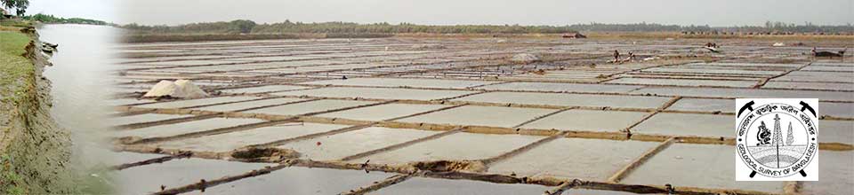
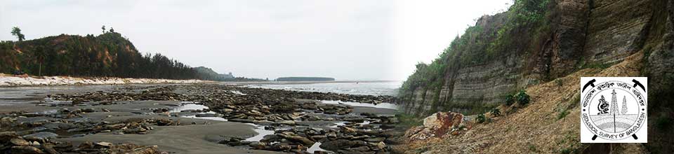
কক্সবাজার
|
কক্সবাজার সদর
|
- Mapping for Phosphorite prospect at scale of 1:20000 (1977)
- Occurrence of Red-oxide (1983)
- Investigation on radioactive beach sand (1966)
- Geological map at scale 1:50000 (October,2014)
- Geomorphological map at scale 1:50000 (2014)
- Geotechnical map at scale 1:50000 (2014)
- Detailed geological investigation (2014)
- Engineering geological investigation (2014)
- Detailed geological study on coastal areas ( 2007)
- Causes of the severe erosional process (2014)
- Geological condition of the marine drive road (2014)
- Geological map of the coastal plains from Nuniachhara to Inani at scale 1:50000 (2014)
- Geomorphological map of the coastal plains from Nuniachhara to Inani at scale 1:50000 (2014)
- Investigation on June,2010 landslides (2011)
|
|
চকোরিয়া
|
- Geological analysis for devastating landslides on 26 June 2012 (2012)
- Geological map of (Satkania-Dulahazara) at scale 1:50000 (1984)
- Stratigraphy of this area (1984)
- Mineral resource investigation (1984)
- Geologic map at scale 1:50000 (1984)
|
|
পেকুয়া
|
-
|
|
কুতুবদিয়া
|
-
|
|
মহেশখালী
|
- Geological map of (Moheskhali, materbari, Sonadia Island) at scale 1:50,000 (1978)
- Geological and geotechnical characteristics analysis (2012)
- Geotechnical characteristics analysis (2012)
- Geological map at scale 1:50000 (2012)
- Geomorphological map at scale 1:50000 (2012)
|
|
রামু
|
- Geological map at scale 1:50,000 (1974)
- Geology of Idgarh-Yanchha area (1970)
- Occurrence of Red-oxide (1983)
- Detailed geological study on coastal areas ( 2007)
- Mapping for Phosphorite prospect at scale of 1:20000 (1977)
- Geological analysis for devastating landslides at 26 June 2012 (2012)
|
|
উখিয়া
|
- Geological analysis for devastating landslides at 26 June 2012 (2012)
- Reconnaissance for Gundum laterite deposit (1968)
- Metallic mineral investigation (1989)
- Geoenvironmental analysis of refugee camp and surrounding areas (2020)
- Landslide zonation map of refugee camps at scale 1:50000 (2020)
- Identification of foraminifera (13 species ) (2014)
- Detailed geological study on coastal areas (2007)
- Investigation on June, 2010 landslides (2011)
|
|
টেকনাফ
|
- Stratigraphy of Saint Martin’s Island (1958)
- Shelly and Coralline Limestone Investigation at Saint Martin’s Island (1958)
- Geomorphological map of Saint Martin’s island at scale 1:50000 (May,2016)
- Detailed geological investigation of Saint Martin’s island (May,2016)
- Geoenvironmental analysis of refugee camp and surrounding areas (2020)
- Landslide zonation map of refugee camps at scale 1:50000 (2020)
- Detailed geological study on coastal areas (2007)
- Investigation on the July 2008 landslides (2008)
- Depositional environmental analysis using foraminifera (26 classes) (2014)
- Change detection map of Cox’s Bazar- Teknaf at scale 1:50000 (2014)
- Land development, sedimentation and neotectonic activity analysis (2014)
- Investigation on June, 2010 landslides (2011)
|
|
ঈদগাঁও
|
-
|
|
খাগড়াছড়ি
|
খাগড়াছড়ি সদর
|
- Hydrogeological mapping using remote sensing (1994, GSB-Unicef)
- Electrical resistivity sounding survey (1994, GSB-Unicef)
- Hydrogeological map at scale of 1:50000 (1994, GSB-Unicef)
- Landslide hazard zonation map (2019)
- Environmental geological analysis (2019)
|
|
দীঘিনালা
|
-
|
|
মহালছড়ি
|
- Investigation on occurrence of Pyrite (1951)
|
|
পানছড়ি
|
-
|
|
মাটিরাঙ্গা
|
-
|
|
মানিকছড়ি
|
-
|
|
লক্ষীছড়ি
|
-
|
|
রামগড়
|
- Geological map of ( Karerhat-kalia-Jaliapara-Ramgarh road section) at scale 1:50000 (1986)
|
|
গুইমারা
|
-
|
|
বান্দরবান
|
বান্দরবান সদর
|
- Stratigraphic succession along Keranirhat-Bandarban road section (1984)
- Landslide inventory (1993)
- Prospect of Clinker clay deposits (chemical analysis, %, reserve estimation, economic assessment) (2011)
- Cause detection of Hill cracking and subsidence of the Islampur-Longipara Road (2012)
- Investigation of landslide on 13 June 2017 (2020)
- Occurrence of construction stones (1980)
|
|
লামা
|
- Prospect of Clinker clay deposits (chemical analysis, %, reserve estimation, economic assessment) (2011)
- Geological analysis for devastating landslides at 26 June 2012 (2012)
- Geology of Idgarh-Yanchha area (1970)
- Occurrence of Coal at Uchekpara (1970)
|
|
আলীকদম
|
- Hydrogeological mapping using remote sensing (1994, GSB-Unicef)
- Geology of Ali kadam quadrangle (1972)
- Prospect of Clinker clay deposits (chemical analysis, %, reserve estimation, economic assessment) (2011)
|
|
নাইক্ষ্যংছড়ি
|
- Geological analysis for devastating landslides at 26 June 2012 (2012)
- Investigation on June, 2010 landslides (2011)
|
|
রুমা
|
- Geological map at scale 1:2,00,000 (1985)
- Prospect of Clinker clay deposits (chemical analysis, %, reserve estimation, economic assessment) (2011)
|
|
রোয়াংছড়ি
|
- Geological map at scale 1:2,00,000 (1985)
- Prospect of Clinker clay deposits (chemical analysis, %, reserve estimation, economic assessment) (2011)
|
|
থানচি
|
-
|
|
রাঙ্গামাটি
|
রাঙ্গামাটি সদর
|
- Stratigraphy of this area (1986)
- Geological map at scale ( part of Sitapahar anticline) at scale 1:50,000 (2008)
- Geological map along Rangamati-Ghagra road section at scale 1:50,000 (1986)
- Geological map of Rangamati Pourashava and adjoining area at scale 1:50,000 (2008)
- Geomorphological map of Rangamati town and adjoining area at scale 1:50,000 (2008)
- Engineering geological map of Rangamati Pourashava and adjoining area at scale 1:50,000 (2008)
- Hazard map of Rangamati Pourashava and adjoining area at scale 1:50,000 (2008)
- Landslide location map of Rangamati Pourashava and adjoining area at scale 1:50,000 (2008)
- Geological map of Rangamati Pourashava and adjoining area at scale 1:50,000 (2008)
- Environmental and land suitability map of Rangamati Pourashava and adjoining area at scale 1:50,000 (2008)
- Intensity map of Rangamati-Barkal earthquake on 27 July 2003. (2003)
- Tectonic and structural geologic map showing elements responsible for earthquake at scale 1:100,000 (2003)
- Investigation on landslide at Bangladesh Rifles Headquarter (1990)
- Landslide inventory (1993)
- Mapping for Phosphorite prospect at scale of 1:20000 (1977)
- Occurrence of Red-oxide (1983)
- Investigation of landslide on 13 June 2017 (2020)
- Hydrogeological mapping using remote sensing (1994, GSB-Unicef)
- Geological map at scale1:50,000 (1977)
- Geology of different sites for 92 permanent head quarter(1970)
- Mineralogical and Chemical analysis of sedimentary rocks (2019)
- Percentage of Minerals in sedimentary rocks (2019)
- Occurrence of economical resources (2019)
- Geological map at scale 1:50000 (2019)
- Diagenesis of Neogene shales (1994)
- Clay mineralogy of Neogene shales (1994)
- Stratigraphic succession of Gaghra area (1994)
|
|
নানিয়ারচর
|
-
|
|
লংগদু
|
-
|
|
বাঘাইছড়ি
|
-
|
|
বরকল
|
- Intensity map of Rangamati-Barkal earthquake on 27 July 2003. (2003)
- Tectonic and structural geologic map showing elements responsible for earthquake at scale 1:100,000 (2003)
|
|
জুরাছড়ি
|
- Investigation of landslide on 13 June 2017 (2020)
|
|
বিলাইছড়ি
|
- Investigation of landslide on 13 June 2017 (2020)
|
|
রাজস্থলী
|
|
|
কাপ্তাই
|
- Suitability of light-weight indigenous rock (Shales, Claystones, etc.) for production (1969)
- Investigation of landslide on 13 June 2017 (2020)
- Reserve of light-weight indigenous rock aggregates (1969)
- Landslide inventory (1993)
- Geological map of (Chandroghona-Kaptai, southern part of the Karnaphuli River) at scale 1:50000 (1979)
|
|
কাউখালী
|
- Geological map at scale1:50,000 (1977)
- Geology of Betbunia area (1977)
|
|
কুমিল্লা
|
কুমিল্লা আদর্শ সদর
|
-
|
|
দেবিদ্বার
|
-
|
|
হোমনা
|
-
|
|
সদর দক্ষিন
|
-
|
|
বরুড়া
|
-
|
|
দাউদকান্দি
|
-
|
|
ব্রাহ্মনপাড়া
|
-
|
|
বুড়িচং
|
- Geological map at scale 1:50000 (1998)
|
|
চৌদ্দগ্রাম
|
- Geological map of Batisa-Jagannath Dighi at scale 1:15840 (1970)
- Prospect of silica sand deposit (1970)
- Prospect of silica sand deposit as glassware in Batisa (1972)
- Prospect of silica sand deposit of Jagannath Dighi and Duttasar area (1974)
- Evaluation of commercially significant glass sand (2009)
|
|
মুরাদনগর
|
-
|
|
মনোহরগঞ্জ
|
-
|
|
লাকসাম
|
-
|
|
নাঙ্গলকোট
|
-
|
|
তিতাস
|
-
|
|
চান্দিনা
|
-
|
|
মেঘনা
|
-
|
|
লালমাই
|
- Red clay Comparison with other geologically deposited Red clayes (2011)
- Mineralogical analysis of sediments of Lalmai hills (47 samples) (1993)
|
|
ফেনী
|
ফেনী সদর
|
- Clay mineralogy of Neogene shales (1998)
|
|
ছাগলনাইয়া
|
-
|
|
সোনাগাজী
|
- Mineralogical and elemental analysis (2019)
- Valuable mineral investigation (identification, extension, reserve, economic viability) at channel bars of Muhuri (Feni) river, Little Feni river (2019)
|
|
ফূলগাজী
|
-
|
|
পরশুরাম
|
-
|
|
দাগনভূঞা
|
-
|
|
ব্রাহ্মণবাড়িয়া
|
ব্রাহ্মণবাড়িয়া সদর
|
- Geological map at scale 1:50000 (2008)
- Quaternary stratigraphy (2008)
- Geology of this area (2008)
- Tectonic geomorphology of this area (2008)
- Geomorphological pattern change analysis (2008)
- Hazards of this area (2008)
|
|
আশুগঞ্জ
|
-
|
|
আখাউড়া
|
-
|
|
নবীনগর
|
-
|
|
নাসিরনগর
|
-
|
|
কসবা
|
-
|
|
বাঞ্ছারামপুর
|
-
|
|
সরাইল
|
-
|
|
বিজয় নগর
|
- Occurrence of peat (2012)
- Physico-chemical characteristics of peat (2012)
- Reserve, extension, & economic aspect of peat (2012)
- Mining potentiality of peat (2012)
- Chemical characterization of Peat (2018)
- Fuel value improvisation of Peat (2018)
|
|
নোয়াখালী
|
নোয়াখালী সদর
|
-
|
|
কবিরহাট
|
-
|
|
কোম্পানীগঞ্জ
|
- Mineralogical and elemental analysis (2019)
- Valuable mineral investigation (identification, extension, reserve, economic viability) at channel bars of Meghna River (2019)
|
|
চাটখিল
|
- Geological map of Manikpur at scale 1:50,000 (1964)
|
|
বেগমগঞ্জ
|
-
|
|
সুবর্ণচর
|
- Mineralogical and elemental analysis (2019)
- Valuable mineral investigation (identification, extension, reserve, economic viability) at channel bars of Meghna River (2019)
|
|
সেনবাগ
|
-
|
|
সোনাইমুড়ি
|
-
|
|
হাতিয়া
|
- Hatia island’s change detection map (size, position and shape) from 1778 to 1985 (1985)
- Seismic time contours and total magnetic field anomaly contour map at scale 1:100,000 (1985)
- Bathymetric chart of Shahabazpur channel at scale 1:75,000 (1985)
- Soil survey map at scale 1: 125,000 (1985)
- Stratigraphy and columnar section of Pit holes at scale 1:50,000 (1985)
- Geologic map of northern part of Hatia Island at scale 1:50,000 (1985)
- Mineralogical and elemental analysis (2019)
- Valuable mineral investigation (identification, extension, reserve, economic viability) at channel bars of Meghna River (2019)
|
|
চাঁদপুর
|
চাঁদপুর সদর
|
- Geological map at scale 1:50,000 (2005)
- Mineralogical and elemental analysis (2019)
- Valuable mineral investigation (identification, extension, reserve, economic viability) at channel bars of Meghna River (2019)
|
|
হাজীগঞ্জ
|
-
|
|
শাহরাস্তি
|
-
|
|
হাইমচর
|
- Geological map at scale 1:50,000 (2005)
- Mineralogical and elemental analysis (2019)
- Valuable mineral investigation (identification, extension, reserve, economic viability) at channel bars of Meghna River (2019)
|
|
ফরিদগঞ্জ
|
-
|
|
কচুয়া
|
- Deep aquifer characterization and mapping (2003, GSB-BAMWSP-BWDB)
|
|
মতলব উত্তর
|
- Geological map at scale 1:50,000 (2005)
- Mineralogical and elemental analysis (2019)
- Valuable mineral investigation (identification, extension, reserve, economic viability) at channel bars of Meghna River (2019)
|
|
মতলব দক্ষিণ
|
- Geological map at scale 1:50,000 (2005)
- Mineralogical and elemental analysis (2019)
- Valuable mineral investigation (identification, extension, reserve, economic viability) at channel bars of Meghna River (2019)
|
|
লক্ষ্মীপুর
|
লক্ষ্মীপুর সদর
|
- Mineralogical and elemental analysis (2019)
- Valuable mineral investigation (identification, extension, reserve, economic viability) at channel bars of Meghna River (2019)
|
|
কমলনগর
|
- Mineralogical and elemental analysis (2019)
- Valuable mineral investigation (identification, extension, reserve, economic viability) at channel bars of Meghna River (2019)
|
|
রামগঞ্জ
|
-
|
|
রামগতি
|
- Mineralogical and elemental analysis (2019)
- Valuable mineral investigation (identification, extension, reserve, economic viability) at channel bars of Meghna River (2019)
|
|
রায়পুর
|
-
|